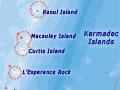
Kermadec Islands map
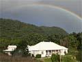
Department of Conservation hostel, Raoul Island, 2009
Underwater volcanoes
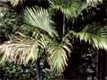
Pōhutukawa and nīkau (1 o 3)
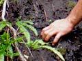
Planting a Raoul Island hebe, 2010 (2 o 3)
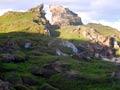
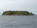
Low-growing vegetation, Cheeseman Island (3 o 3)
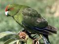
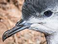
Kermadec parakeets, Macauley Island (1 o 5)
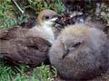
Kermadec petrel and chick (2 o 5)
Kermadec little shearwater (3 o 5)
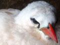
Red-tailed tropic bird (4 o 5)
White-naped petrels, Macauley Island (5 o 5)
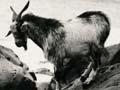
Goats and a dog on Raoul Island, 1908
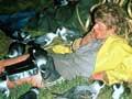
Spraying Mysore thorn, 1976
Pou whenua on Raoul Island
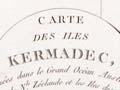
Chart from d'Entrecasteaux's 1793 voyage
Hoisting the flag at the Bell settlement, 1887 (1 o 3)
Thomas Bell's garden, 1892 (2 o 3)
Frederica Bell at Denham Bay, 1908 (3 o 3)
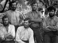
1908 expedition
Castaway depot on Curtis Island, 1917
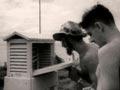
Meteorologists on Raoul Island, 1949
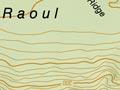
Topographic map of Raoul Island, 2011
Royal New Zealand Navy disembarking stores
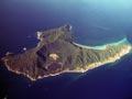
Aerial view of Raoul Island (1 o 2)
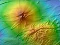
Bathymetry of Raoul Island and offshore volcanoes (2 o 2)
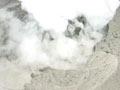
2006 eruption
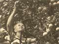
Harvesting oranges, Raoul Island
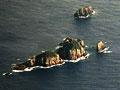
Meyer Islands and Herald Islets
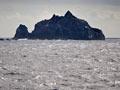
L'Esperance Rock, southern Kermadecs
Macauley Island
Petrels on Macauley Island
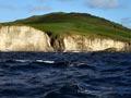
Cheeseman and Curtis islands